Ride
Intermediate
Steady, with some endurance
PUERTO DEL MALAGÓN-ALTO DE ABANTOS-ABANTOS
Organized by the group
España · Puertos de Montaña
Madrid
Bike
Carretera · Gravel
Distance
—
Elevation
854 m
Duration
—
Meeting point
San Lorenzo de El Escorial
View route
PUERTO DEL MALAGÓN -ALTO DE ABANTOS-ABANTOS
About this ride
📍 STARTING POINT : El Tomillar Restaurant. Next to the El Tomillar parking lot, San Lorenzo de El Escorial (Madrid)
📅 DATE : Sunday, September 20.
⏰ MEETING TIME : 09:30 h
TECHNICAL SPECIFICATIONS
📏 Distance : Approx. 30 km
⛰️ Positive elevation gain : approx. 854 m
🟢 Physical difficulty: High
🟡 Technical difficulty : Moderate
🔄 Type of route : Round trip
🚲 Bike type : MTB · Gravel · e-MTB
🌲 Terrain type : Mountain tracks and paths, with sections of uneven surface
GENERAL DESCRIPTION OF THE ROUTE
The route starts from the El Tomillar parking area in San Lorenzo de El Escorial. From the picnic area, we will begin the walk along a paved track that gradually ascends, taking us into the natural environment of Mount Abantos.
In this first section we will pass by the InsectPark, an educational center dedicated to the world of insects and other arthropods.
Afterwards we will visit the Luis Ceballos Arboretum, an environmental education space that houses one of the most important collections of native trees and shrubs of the Iberian Peninsula and Balearic Islands, created in homage to the forestry engineer and botanist Luis Ceballos.
We will arrive at the Puerto de Malagón, a mountain pass located on the slopes of Abantos, between the provinces of Madrid and Ávila, and very well known among cyclists and hikers.
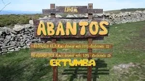
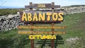
We will continue to Alto de Abantos, one of the highlights of the mountain range, where we will take a short break to replenish our energy.
From the Alto de Abantos we will return along our own steps to take the turn towards the summit of Abantos, passing by the natural balcony of the Cruz de Rubens, a viewpoint with beautiful views that is named in honor of the famous Flemish painter Rubens, linked to El Escorial.
Finally, we'll reach the Abantos Cross, located at the highest point, one of the most recognizable landmarks of this route. The last few meters are along a very stony path, so extra caution is advised; those who need to can walk.
From this location we can enjoy panoramic views over the Monastery of San Lorenzo de El Escorial, the Madrid plateau and, on clear days, a large part of the Sierra de Guadarrama.
A challenging but especially beautiful outing, with the aim of enjoying the journey.
⚠️ SAFETY AND RECOMMENDATIONS
🪖 Helmet required.
💧 Bring enough water and food.
🚰 There are fountains along the route, but their availability and the potability of the water are not guaranteed.
🔧 Puncture repair kit and basic tools.
📱 GPS or mobile phone with the track downloaded.
🔄 All necessary regroupings will be carried out at the agreed points.
🚴 Each participant will be able to adapt the pace of the route according to their level and circumstances.
💪 INDIVIDUAL RESPONSIBILITY
🚴 Each participant is responsible for their own safety and compliance with traffic regulations.
💪 It is the responsibility of each person to assess beforehand whether the route is suitable for their physical and technical level and the condition of their bicycle.
🤝 The person proposing the outing acts solely as the creator of the activity, without professional status or assumption of responsibility for accidents, incidents or any other circumstance that may occur during the route.
🔄 Participation in the route is entirely voluntary and each cyclist freely decides to participate, continue, modify or abandon the route according to their circumstances.
📍 GPS TRACK
https://loc.wiki/t/233560232?h=gp2yjwe2zv&wa=sd&la=es
https://loc.wiki/t/224879955?h=gp2yjwe2zv&wa=sd&la=es
Organized by
Yolanda
3 signed up
Sign in to see who has signed up
Photos
Galería de fotos
1 / 1