ASCENT TO THE PORT OF LA QUESERA

Are you joining?
2 people joined

About this ride
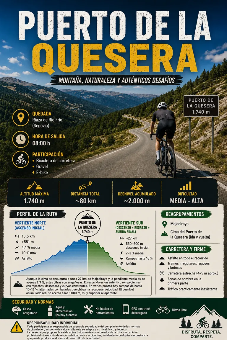
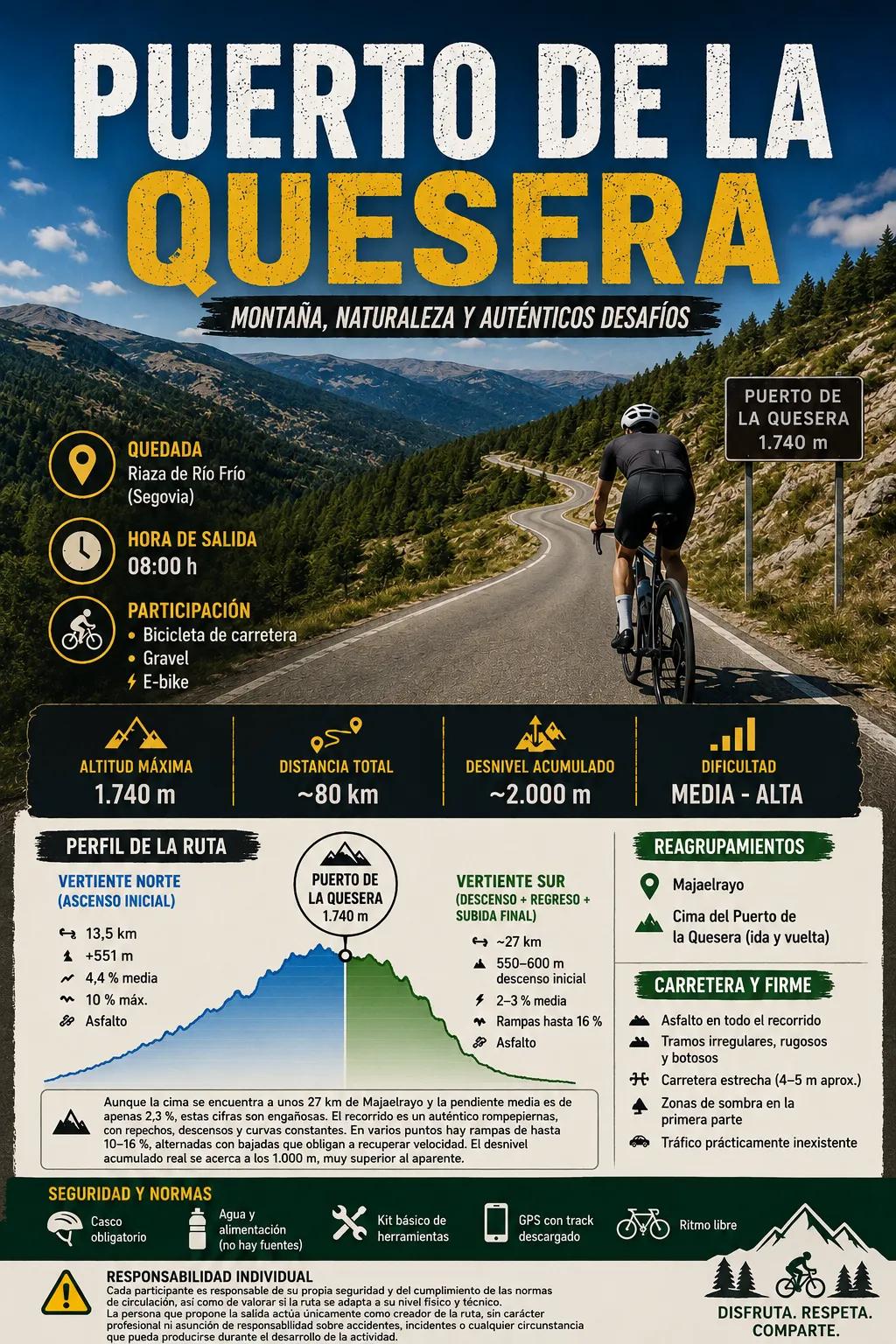
📍 Meetup Riofrío de Riaza/Riaza (Segovia) The meeting point will be agreed upon in the group. 🕗 Departure time 08:15 h (flexible schedule, can be adjusted) STAKE 🚴♂️ Road bike 🚵♂️ Gravel ⚡ E-bike 🌲 GENERAL DESCRIPTION Departure from Riaza or from Riofrio de Riaza, a mountain village with an authentic mountain atmosphere. The route climbs steadily towards the Puerto de la Quesera pass (1,740 m) along its northern slope, winding through Scots pine forests and the Pedrosa Beech Forest in an increasingly alpine environment as altitude is gained. This pass is relatively unknown and sees very little traffic, allowing for a peaceful ascent surrounded by nature and offering magnificent views of the Sierra de Ayllón mountain range. After reaching the summit, the route descends along the southern slope, entering the Sierra Norte of Guadalajara, and the profile becomes more undulating, with fast sections and very quiet roads. In Majaelrayo, a brief stop will be made to replenish energy in one of the most representative villages of black architecture, surrounded by a spectacular mountain environment. From here begins the return journey and one of the key points of the route: the climb to the Puerto de la Quesera pass via its southern slope. This is a long, uneven, and very deceptive ascent, where the average gradient doesn't reflect the true effort due to its leg-breaking nature, with continuous changes of pace, short, steep climbs, and rolling hills before reaching the summit. At several points, there are ramps of up to 10–16%, interspersed with descents that force riders to regain speed. The actual total elevation gain is close to 1,000 meters. ROUTE PROFILE North face (initial ascent) 📏 13.5 km from Riaza. 8.6 km from Ríofrío de Riaza ⬆️ +551 m 📊 4.4% average ⚠️ 10% max. 🌲 South slope (descent + final ascent) 📏 ~27 km ⬇️ 550–600 m 📊 2–3% average ⚠️ Occasional ramps up to 16% (maximum) Total ⬆️ 1945 m of cumulative elevation gain 📏 Approximately 80 km ROAD TYPE AND CONDITION 🧱 Asphalt throughout the route 🪨 Irregular, rough and bumpy sections typical of a little-traveled mountain road, with loss of uniformity and a feeling of a poorly maintained road in some places 🛤️ Narrow road (approx. 4–5 m) 🌲 Shaded areas in the first part 🚗 Virtually non-existent traffic ⚙️ DIFFICULTY 🔶 MEDIUM – HIGH REGROUPS 📍 Majaelrayo 🏁 Summit of Puerto de la Quesera (1st and 2nd summit) SAFETY AND STANDARDS 🪖 Helmet required 💧 Sufficient water and food 🚱 There are no water fountains along the entire route 🔧 Basic tool kit 📱 GPS with downloaded track 🚴 Freestyle ⚠️ INDIVIDUAL RESPONSIBILITY - Each participant is responsible for their own safety and compliance with traffic regulations, as well as assessing whether the route is suitable for their physical and technical level. - The person proposing the outing acts solely as the creator of the route, without professional status or assumption of responsibility for accidents, incidents or any circumstance that may occur during the development of the activity.

Photos
Galería de fotos
1 / 14